Introduction to Our GAP Bike Trail Adventure
Great Alleghany Passageway Overview
For bikers and adventureists few trips are more fun and rewarding than traveling the Great Allehany Passageway or GAP. It follows former railroad paths of the old Western Maryland Railroad and several other defunct railroad companies from Pittsburgh through Pennsylvania to Cumberland, Maryland.
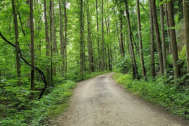
This 150-mile trail is one of the longest rail trails in the United States and offers amazing scenary while riding through southwestern Pennsylvania and western Maryland.
The Adventurous Bikers
There are four of us planning to take the three day trip:
- Rob Halminksy
- C. Hurst
- Carl Roberts
- Mark Brown
Rob and Carl put together the idea to bike the 150 mile GAP trail. Mark got invited and we added C. Hurst. C has done the other half of the trail from Cumberland, MD to Washington, DC so we looking forward to his insightful recommendations. We decided to stay in hotels for three nights rather than camp. All gear will be carried on our bikes. We will eat at stops along the way along with a couple of protein bars packed in our bags.
Tentative Itinerary
Rendezvous – We meet in Cumberland, MD at WheelzUp Bike Shop, 14 Howard Street on Monday, May 13th at 12 Noon. We park our cars for three days.
Travel to Pittsburgh – At 1:00 PM we ride a shuttle van with our bikes and gear to Pittsburg, PA and bike 150 miles over three days back to our cars.
The first night, Monday, before we start riding we stay at the Fairfield Inn , 435 Fort Pitt Boulevard Pittsburgh.
The next morning, Tuesday, we bike approximately 50 miles to Connellsville on the GAP trail.
Tuesday night - Comfort Inn, 325 North First Street, Connellsville, PA, 15425
Bike another 50 miles to Confluence, PA
Wednesday night - Paddler’s Lane Retreat, 255 Paddler’s Lane, Confluence, PA 15424
Thursday we bike back to our cars in Cumberland, MD.
Trail Description
The trail terrain is approximately 15% paved and 85% gravel surface. There are rolling hills in places throughout the trail but the two ends of the trail are at roughly the same elevation. The highest evalation on the trail is the Eastern Continental Divide located 23.5 miles North of Cumberland. The trail climbs in both directions to reach Divide’s elevation of 2392 feet. The elevation gain from Cumberland is about 1800 feet and about 1700 feet from Pittsburgh.
There are many notable landmarks and beautiful views along the trail but a couple of stand outs are:
Coming to The Continental Divide 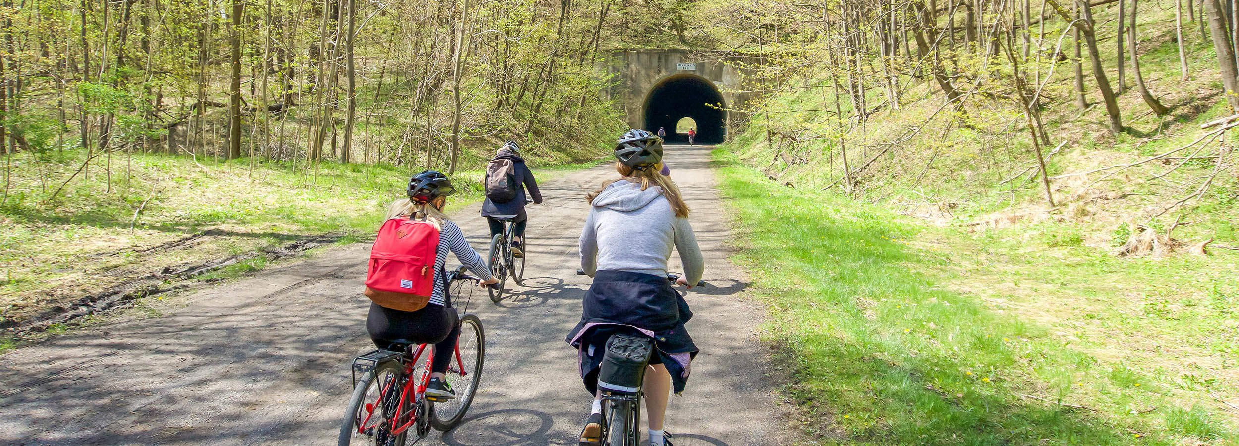
Ohiopyle High Bridge 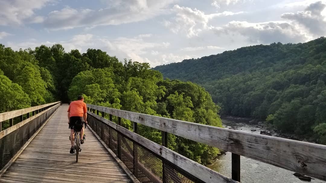
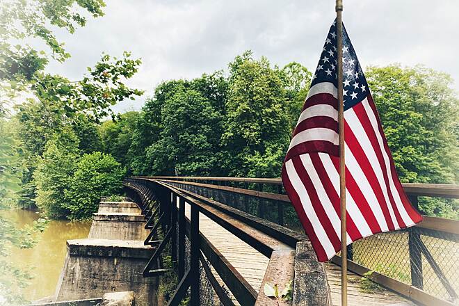
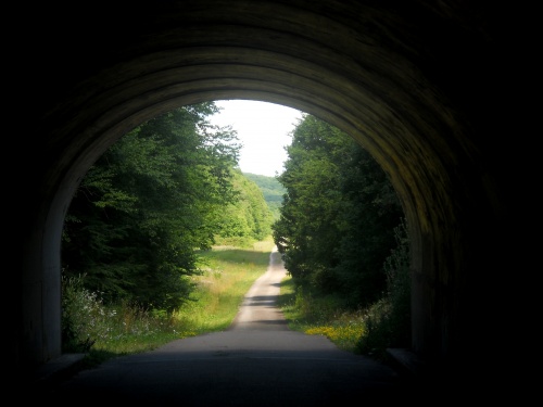
View Departing One of The Many Tunnels
Ohiopyle State Park
Trail History
The Great Allegheny Passage as a bike trail is relatively new. A construction project of almost 30 years in the making, started in 1986 near Ohiopyle. The last section to be completed was the most Northern section from West Homestead to downtown Pittsburgh in June 2013. Being a former railroad, the trail is very flat, and once outside downtown Pittsburgh there is no motorized traffic.
Most of the trail was built on the abandoned grades of the Western Maryland Railway through Connellsville, then on the Pittsburgh and Lake Erie Railroad on to Pittsburgh.
The lines were abandoned since 1975, and the first 9-mile (14 km) section of the rail trail opened near Ohiopyle, Pennsylvania, in 1866. In June 2013, thirty-five years after construction first began, the final section was completed from West Homestead to Pittsburgh at an overall cost of $80 million.